

Swanscombe is a small Kentish town, poised on a chalk ridgeline overlooking the River Thames. Home to the first ‘British Cement’ works back in 1825, quarrying has since gnawed away at the river-facing hillside. From the station it’s a short walk to the London Road, which now borders a vertical drop to the quarry below.
Directly across the London Road, next to the George and Dragon, a public footpath traces a narrow chalk spine down towards the Swanscombe Peninsula and the river. Glimpses through fencing and vegetation provide a view down to the industrial units which have repurposed the quarries on either side.
The Swanscombe Peninsula
As the path flattens out it crosses Manor Way and continues alongside a drainage canal. Not far to the right, unseen and unheard, Eurostar trains surface and dive beneath the marshes, tracing a route below the Thames.

An abandoned sewer works on the right has left little trace, while huge electricity pylons dominate the skyline.
After passing a large drainage pond on the left, the path reaches a T-junction. There is also an unmade road here, one of several tracking across the Swanscombe Peninsula. The tracks serve an isolated and ramshackle community of stilted shacks and boats at Broadness Harbour, but also the regular security patrols that guard this area. It’s not the muddy creek at Broadness they’re protecting, or the pylons, but the interests of a company called London Resort Company Holdings.

The Swanscombe Peninsula has a long history of industrial use, with aggregate, cement and gas works, as well as waste tipping. But, as industry declined, this remote, marshy landscape has been rapidly reclaimed by nature, and the drainage canals are now home to endangered water voles, while kites hover overhead.
‘Pre-used’ sites like this are known as brownfield, and while often dismissed as valueless, they are often home to some of our most endangered wildlife species.

However, London Resort Company Holdings want to build a huge theme park here, with 747,000 square metres of buildings, 14,000 parking spaces and 15m visitors every year. Currently they have the support of Paramount Pictures, the BBC and ITV. So their security firm patrols the Peninsular, accompanied by aggressive Alsatians, and will firmly redirect you if find you on the ‘wrong’ path.
Heading upriver
Heading west, towards the distant Queen Elizabeth II Bridge, Greenhithe can be seen, already biting into the Peninsula’s vulnerable flanks with new builds. Across the Thames, riverside chemical works are dwarfed by distance.

Once in Greenhithe, the path dips back and forth along the riverside, confusing the walker with dead-ends and U-turns. It’s better to keep to the surprisingly well-preserved High Street, and then skirt the Asda supermarket and Johnsons Wharf, to regain the river. A slightly more direct, narrow footpath nudges around the back of the supermarket before squeezing out into a petrol station.
Now back at the riverside it is possible to scramble down to the Thames foreshore, where shingle and sand slope down to the more familiar gloop of river mud. Edible samphire and sea beet grow here, but with Longreach Sewage Treatment Works discharging into the river upstream, it’s best to leave the plants unharvested.

The path passes under a concrete pontoon, currently used for car imports/exports, and heads towards the towering support columns of the QEII Bridge. Across the river, ranks of white oil storage tanks sit next to West Thurrock Marshes. The marshes were once used for ash-dumping from the nearby West Thurrock Power Station, now demolished. As at Swanscombe Peninsula, wildlife reclaimed the site and it is now protected as a Site of Special Scientific Interest, home to more than 1,300 different species of invertebrates, bird and reptiles.
Passing below the QEII Bridge the thump and bump of traffic can be heard some 60 metres (200 feet) above.

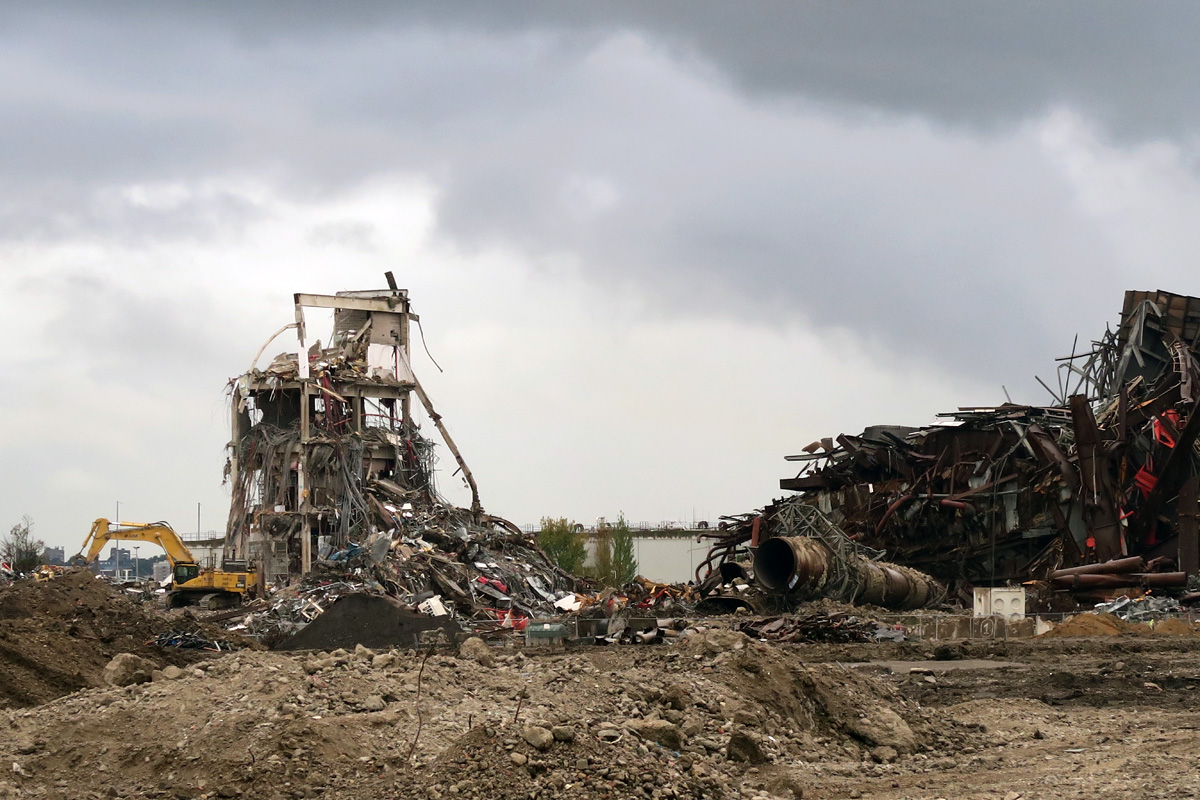
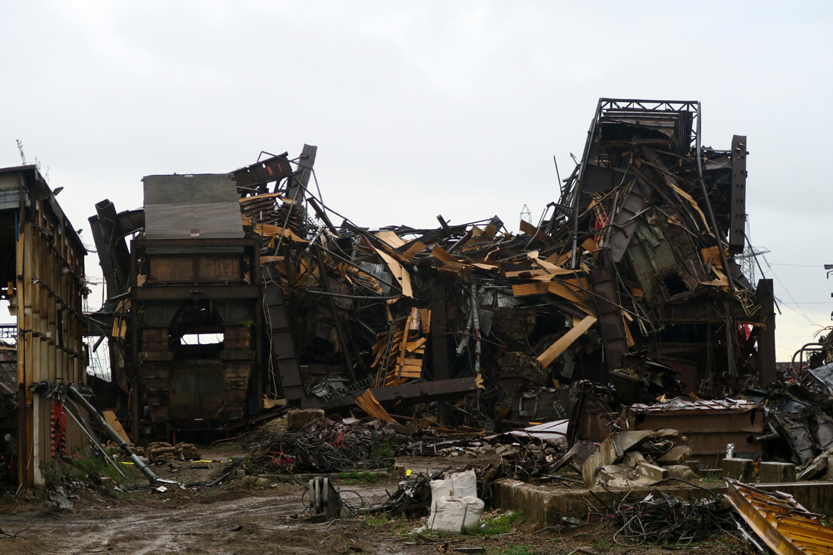
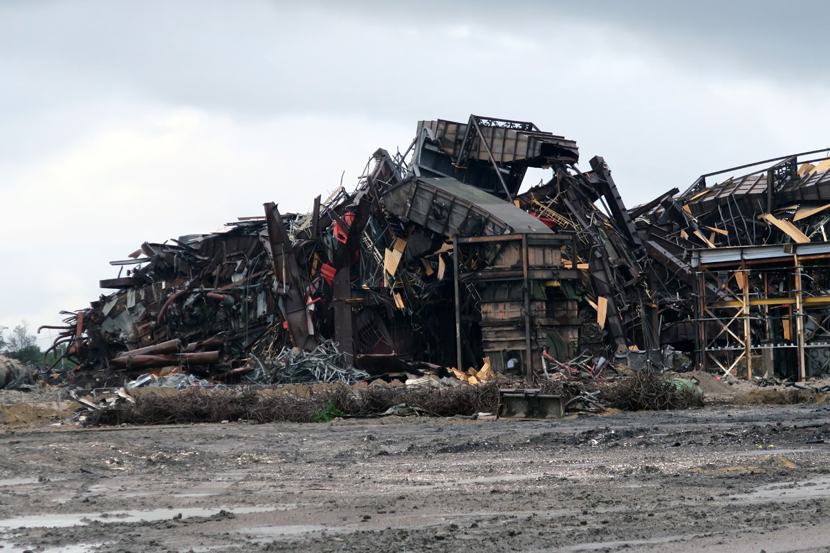
Littlebrook Power Station once dominated the riverside path beyond the bridge, but is currently being demolished. Only the 215 metre (705 feet) chimney remains intact for now. The oil and coal-fired station was unable to meet EU pollution legislation and shut down in 2015.
Demolition of Littlebrook Power Station
The aforementioned Longreach Sewage Treatment Works comes next. New technology and recent investment means there is little or no odour here, and the discharge into the Thames is much cleaner than it used to be. However, the warm, nutrient-rich flow continues to attract gulls, which float downstream of the upwelling waters, searching for potential snacks.
Dartford Marshes
The river path now skirts the flat expanse of Dartford Marshes, which lie inland, beyond the river embankment. Unexpected gunfire indicates an unseen but nearby shooting club, hunkered down on the marshes, but otherwise this is a remote, little-visited path.

The wide, flat landscape ahead is broken only by a large concrete, box-like structure, which squats over the unseen River Darent. This is the Dartford Creek Barrier, which, along with the Barking Creek Barrier and the Thames Barrier, holds back Thames tidal surges and prevents flooding.

The River Darent
The path heads inland here, away from the Thames and following the sinuous weaves of the tidal Darent. As the tide drops the Darent slips lower, revealing muddy banks, a feeding ground for winter wildfowl. After about 1.5km the River Cray flows into the Darent from the opposite bank.

The path wiggles a few more times towards the A206, a fast and noisy dual carriageway. There are at least seven WW2 concrete structures around here, probably used for the storage of anti-aircraft ammunition. These are now roofless, crumbling and overgrown.
The route now leads to the dual carriageway and a metal kissing gate, but also drops unsurely towards the river and into the gloom below the road. This section is often flooded and too deep to wade, but it is possible to carefully walk or shuffle along the top of a low concrete wall to get past.
The path now traces past Dartford Fresh Marshes, although the opposing bank is now built up. A supermarket warehouse and modern housing stand where factories and wharves once faced the river. After a derelict and easily overlooked lock, industrial estates move in on both sides. The path crosses the river via a footbridge and joins Hythe Street. Dartford Railway Station is about seven minutes’ walk from here, with regular trains back to London.
You must be logged in to post a comment.